Westboro
The west end's original village: Richmond Road shops and cafes, early-1900s streets, and the Ottawa River a few blocks north.
* Ottawa Neighbourhood Study figures for its “Westboro” area, which is larger than Westboro alone.
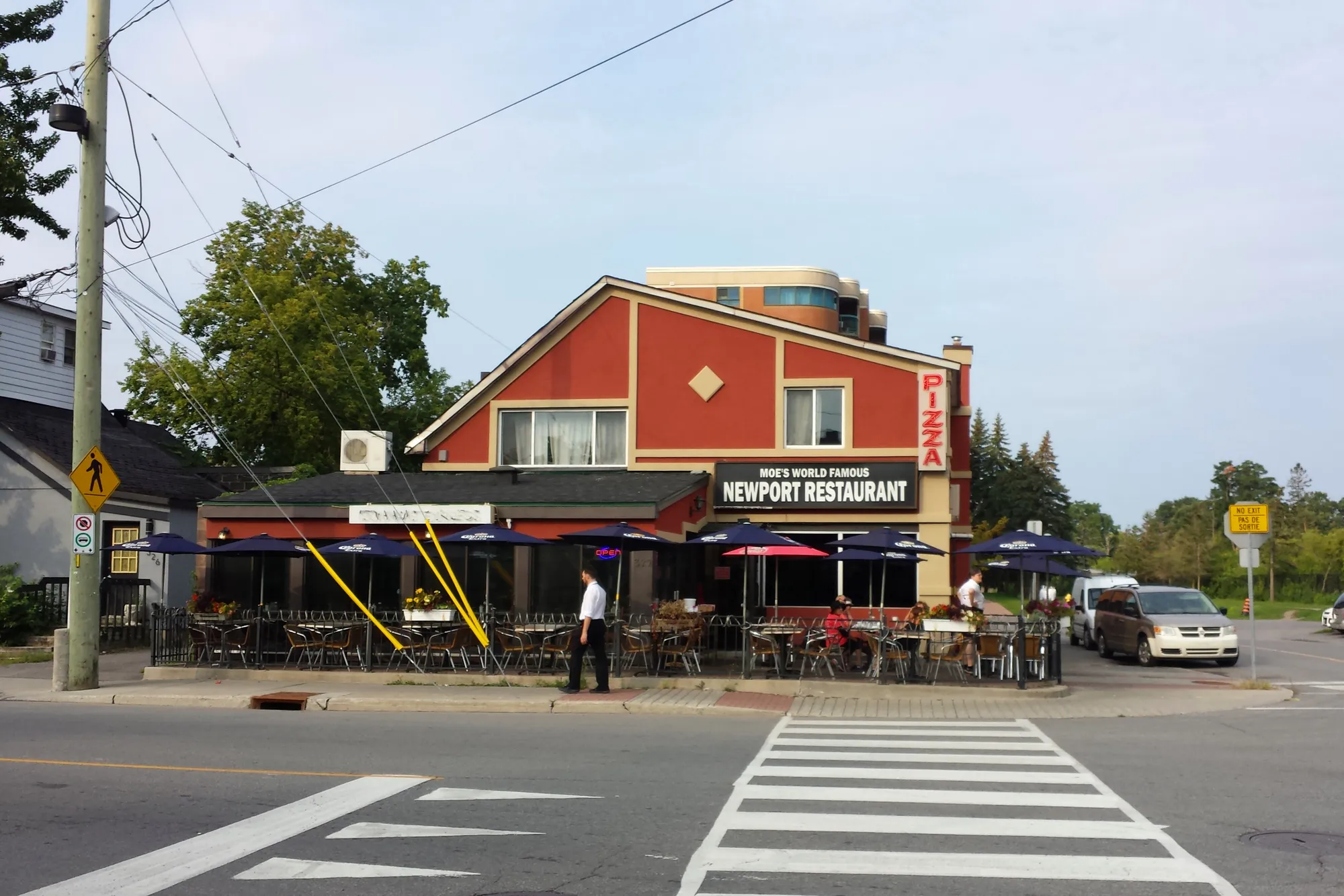
Westboro, often called Westboro Village, grew up along Richmond Road, the old Macadam Road to Bells Corners, and was a police village until Ottawa annexed it in 1949. From the Westboro centre it is about 3 minutes to Churchill Alternative School (OCDSB), 8 to Real Canadian Superstore and 9 to the future Kichi Zìbì (formerly Dominion) O-Train station (under construction, opening listed for 2027) on foot (OSRM estimates). The Ottawa Neighbourhood Study's 'Westboro' area had 12,280 residents in the 2021 census.
Updated · Facts on this page link to their sources
From the Westboro centre
Walking and driving times to the nearest schools, O-Train stations and grocery stores.
| To | Nearest | Walk | Route | Drive |
|---|---|---|---|---|
| Elementary school | Churchill Alternative School (OCDSB) | 3 min | 250 m | 1 min |
| Elementary school | Hilson Avenue Public School (OCDSB, grades JK–6) | 14 min | 1.0 km | 2 min |
| Secondary school | Nepean High School (OCDSB, grades 9–12) | 17 min | 1.3 km | 3 min |
| Secondary school | Notre Dame High School (OCSB, grades 7–12) | 25 min | 1.9 km | 4 min |
| O-Train (open) | Tunney's Pasture | 30 min | 2.3 km | 4 min |
| O-Train (under construction) | Kichi Zìbì (formerly Dominion) (opening listed for 2027, provisional) | 9 min | 650 m | 1 min |
| Grocery store | Real Canadian Superstore | 8 min | 620 m | 1 min |
| Grocery store | Farm Boy | 10 min | 730 m | 2 min |
Estimates from OSRM on OpenStreetMap data: walking at about 5 km/h on streets and paths (no waits at crossings), driving in free-flowing traffic. Calculated 2026-10-30. Map data © OpenStreetMap contributors (ODbL).
About Westboro
Westboro, often called Westboro Village, grew up along Richmond Road, the old Macadam Road to Bells Corners, and was a police village until Ottawa annexed it in 1949. Most of its houses date from 1900 to 1960, and condominium projects along the main streets are now adding density. Richmond Road is the commercial heart, with a concentration of outdoor and sporting-goods stores, boutiques, restaurants and coffee shops, plus murals and the Fuse Street Festival each August. The Ottawa River, its cycling paths and the NCC's Westboro Beach are a short walk north, and the area is served by Westboro and Dominion (Kichi Zìbì) stations, both being rebuilt for the O-Train Line 1 west extension.
Boundaries
Definitions vary. The Westboro Community Association covers east of Denbury Avenue and west of Tweedsmuir Avenue, between Carling Avenue and Scott Street/the Transitway (LRT corridor), plus the block between Tweedsmuir, Richmond Road, Island Park Drive and Scott. Wikipedia's broader definition runs from Island Park Drive in the east to the Ottawa River in the north (including Westboro Beach). For this hub, Westboro is mapped as the village core: Scott Street/Transitway to the north, Island Park Drive (north of Richmond) and Tweedsmuir Avenue (south of Richmond) to the east, Carling Avenue to the south, and Churchill Avenue (south of Richmond Road) / the Denbury Avenue line (north of Richmond) to the west. The area between Churchill and Denbury south of Richmond is shown as Highland Park; the WCA's own area overlaps it. westborocommunityassociation.ca en.wikipedia.org
Homes
Most houses were built between 1900 and 1960, and Wikipedia reports 71% of houses as detached. Several condominium projects are adding density, mainly along the commercial streets. The wider ONS 'Westboro' area (which also takes in Westboro Beach, Laurentian View and Hampton-Iona) was 21.9% single-detached and 42.3% apartments in buildings of five or more storeys in the 2021 census. en.wikipedia.org ons-sqo.ca
- Richmond Road village strip: outdoor and sporting-goods stores, boutiques, restaurants and coffee shops (ONS / Westboro Village BIA)
- Westboro Village BIA has supported the business district since 1979
- Fuse Street Festival takes over Richmond Road one weekend each August
- Westboro Beach (NCC) about 0.7 km from the village centre, with supervised summer swimming and a year-round restaurant
- Westboro and Kichi Zìbì (formerly Dominion) stations are being rebuilt for the O-Train Line 1 west extension (listed for 2027)
- Maplelawn, a National Historic Site with a rare walled garden, sits at the western edge of the village
- Grocery within walking distance: Real Canadian Superstore and Farm Boy are each about 0.6 km from the centre
Community
How Westboro came to be
- late 1800s
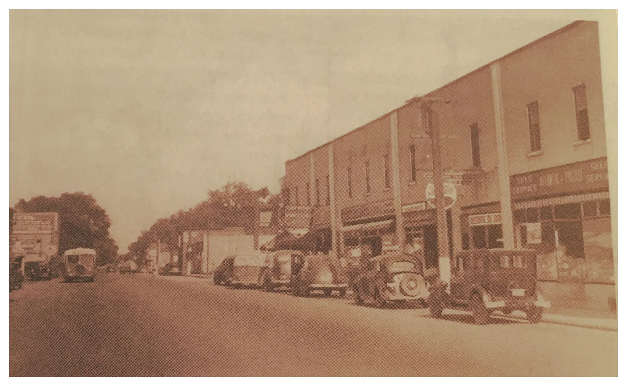
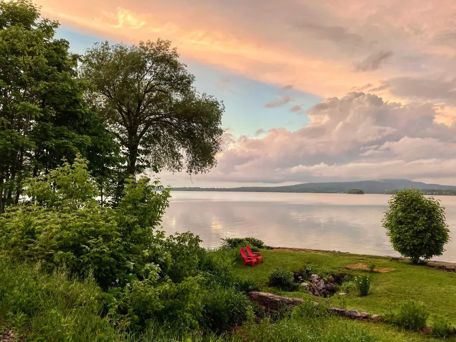
Late-19th-century flyers urged people to "Move to Westboro" and promised "views of the Laurentian Mountains", meaning the Gatineau Hills across the river. en.wikipedia.org
- 1831
Maplelawn (529 Richmond Road), built 1831-1834 for the Thomson family, has a rare walled garden and was designated a National Historic Site in 1989. en.wikipedia.org
- 1903-1949
Westboro was a police village from 1903 until Ottawa annexed it in 1949 (the Highland Park Ratepayers Association's history gives June 10, 1905 for the incorporation and 1950 for the annexation). en.wikipedia.org
- 1940s-1950s
After the Second World War and annexation, Main Street was renamed Churchill Avenue and River Road became Roosevelt Avenue, partly because Ottawa already had streets with those names. en.wikipedia.org
Richmond Road was earlier described as the Macadam Road to Bells Corners; Westboro was once the centre of the old Nepean Township, and the old Town Hall on Richmond Road housed the bell that later became the symbol of the City of Nepean. en.wikipedia.org
An Ottawa Electric Railway streetcar line ran along what is now the Byron Linear Tramway Park, bringing city residents to an area once considered cottage country. en.wikipedia.org
Local names worth knowing
- Bruce Cockburn
Singer-songwriter and guitarist listed among Westboro's notable residents. en.wikipedia.org
- Eddie MacCabe
Sports journalist and writer listed among Westboro's notable residents. en.wikipedia.org
- William Thomson
Scottish-born retired army officer who settled the farm around 1818; Maplelawn was built as the centre of his family's estate. en.wikipedia.org
Around Westboro
Walking rings at 5, 10 and 15 minutes from the neighbourhood centre.
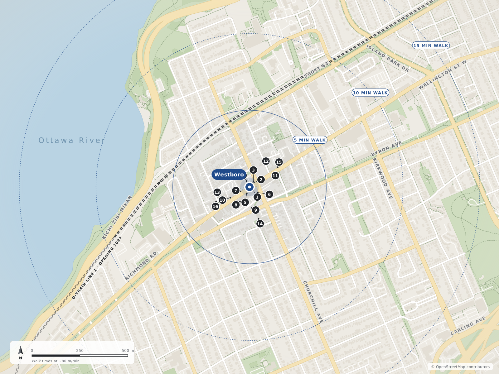
- 1Lexington Smokehouse & Bar20 m
- 2Cloudforest Coffee20 m
- 3Gezellig30 m
- 4Churchill Seniors Recreation Centre40 m
- 5Churchills40 m
- 6Equator Coffee50 m
- 7Pure Kitchen50 m
- 8MEC Mountain Equipment Company90 m
- 9Blyth Academy110 m
- 10Fjällräven110 m
- 11Wedel – Touch of Europe150 m
- 12Elise160 m
- 13The SconeWitch170 m
- 14Churchill Alternative School170 m
- 15Happy Goat Westboro Café180 m
- 16The Piggy Market190 m
Schools
10 nearbyBlyth Academy
Independent352 Danforth Avenueopenstreetmap.org
110 m1 min walkChurchill Alternative School
OCDSB345 Ravenhill Avenue Eastopenstreetmap.org churchillalternative.ocdsb.ca
170 m2 min walkCentre Jules-Léger
Provincial281 Lanark Avenueopenstreetmap.org
820 m10 min walkHilson Avenue Public School
OCDSBGrades JK–6407 Hilson Avenueopenstreetmap.org hilsonaveps.ocdsb.ca
860 m11 min walkNepean High School
OCDSBGrades 9–12574 Broadview Avenueopenstreetmap.org nepeanhs.ocdsb.ca
1.0 km13 min walkBroadview Public School
OCDSBGrades JK–8590 Broadview Avenueopenstreetmap.org broadviewps.ocdsb.ca
1.1 km14 min walkChesterton Academy
Independent415 Piccadilly Avenue Northopenstreetmap.org
1.3 km16 min walkSt. George School
OCSBGrades JK–6130 Keyworth Avenueopenstreetmap.org sge.ocsb.ca
1.4 km18 min walkElmdale Public School
OCDSBGrades JK–649 Iona Streetopenstreetmap.org elmdaleps.ocdsb.ca
1.5 km18 min walkNotre Dame High School
OCSBGrades 7–12710 Broadview Avenueopenstreetmap.org ndh.ocsb.ca ndh.ocsb.ca
1.5 km19 min walk
Straight-line distances from the Westboro centre. Living near a school does not guarantee a place: confirm the designated school for an address with each board. All schools and board locators.
Parks & places
10 nearbyChurchill Seniors Recreation Centre
City of Ottawa seniors' recreation centre on Richmond Road in Westboro.
345 Richmond Roadopenstreetmap.org
40 m1 min walkOttawa River Pathway (Trans Canada Trail)
Multi-use cycling and walking pathway along the Ottawa River, part of the NCC's Capital Pathway network (200+ km of off-road pathways) and mapped in OSM as part of the Trans Canada Trail.
openstreetmap.org ncc-ccn.gc.ca openstreetmap.org
150 m2 min walkLion's Park
City park on Elmgrove Avenue beside the Ottawa Gymnastics Centre, with the Lions summer wading pool.
294 Elmgrove Avenueopenstreetmap.org openstreetmap.org ottawa.ca
320 m4 min walkRoy Duncan Park
City park on Churchill Avenue North; the Paul Dewar Field House is nearby on an Ottawa Community Housing site.
295 Churchill Avenue Northopenstreetmap.org openstreetmap.org
440 m6 min walkClare Gardens Park
Small City park on Clare Street in Westboro (no dogs per OSM).
269 Clare Streetopenstreetmap.org
620 m8 min walkWestboro Beach
NCC-managed sandy beach on the Ottawa River with a designated supervised swim area in summer; the renovated site has pavilions, a year-round restaurant (the Grand Pizzeria) and a seasonal café, and in winter the Kichi Sibi Winter Trail leads directly to the pavilion.
745 Kichi Zībī Mīkanopenstreetmap.org openstreetmap.org ncc-ccn.gc.ca
660 m8 min walkMahoney Park
City park on Lanark Avenue.
160 Lanark Avenueopenstreetmap.org
850 m11 min walkHeather Crowe Park
City park on Scott Street (leashed dogs per OSM).
1902 Scott Streetopenstreetmap.org
890 m11 min walkIona Park
City park on Iona Street with a summer wading pool.
223 Iona Streetopenstreetmap.org openstreetmap.org ottawa.ca
930 m12 min walkWestboro Kiwanis Park
City park beside the Dovercourt Recreation Centre with a supervised outdoor rink in winter and the Westboro wading pool in summer (per OSM/City data).
411 Dovercourt Avenueopenstreetmap.org openstreetmap.org openstreetmap.org
930 m12 min walk
Shops & dining
10 nearbyLexington Smokehouse & Bar
Smokehouse restaurant and bar, a Westboro Village BIA member.
344 Richmond Roadopenstreetmap.org westborovillage.com
20 m1 min walkCloudforest Coffee
Cloudforest Coffee café (OSM lists it with Pokoloko), a Westboro Village BIA member.
339 Richmond Roadopenstreetmap.org westborovillage.com
20 m1 min walkGezellig
Restaurant in Westboro Village, a BIA member.
337 Richmond Roadopenstreetmap.org westborovillage.com
30 m1 min walkChurchills
Pub on Richmond Road, a Westboro Village BIA member.
356 Richmond Roadopenstreetmap.org westborovillage.com
40 m1 min walkEquator Coffee
Equator Coffee café at Churchill Avenue North, a Westboro Village BIA member.
412 Churchill Avenue Northopenstreetmap.org westborovillage.com
50 m1 min walkPure Kitchen
Restaurant on Richmond Road, a Westboro Village BIA member.
357 Richmond Roadopenstreetmap.org westborovillage.com
50 m1 min walkMEC Mountain Equipment Company
MEC outdoor gear store, a Westboro Village BIA member.
366 Richmond Roadopenstreetmap.org westborovillage.com
90 m1 min walkFjällräven
Fjällräven outdoor clothing store, a Westboro Village BIA member.
373 Richmond Roadopenstreetmap.org westborovillage.com
110 m1 min walkWedel – Touch of Europe
Pastry shop, a Westboro Village BIA member.
300 Richmond Roadopenstreetmap.org westborovillage.com
150 m2 min walkElise
French restaurant on Winona Avenue, a Westboro Village BIA member.
381 Winona Avenueopenstreetmap.org westborovillage.com
160 m2 min walk
Getting around
TransitRichmond Road bus corridor
Westboro Village's main street; OSM bus route relations on Richmond Road in the area include routes 11, 51, 81 and 153. Route numbers change — confirm on octranspo.com.
openopenstreetmap.org overpass-api.de
10 m1 min walkOttawa River Pathway (active transportation)
Off-road NCC multi-use pathway along the river, part of the 200+ km Capital Pathway network — a car-free cycling/walking route east toward downtown and west along the river.
openopenstreetmap.org ncc-ccn.gc.ca
150 m2 min walkKichi Zìbì (formerly Dominion)
Future trench-level O-Train station replacing Dominion Transitway station by the Kichi Zībī Mīkan, about 225 m from Richmond Road and close to Westboro Beach. OC Transpo reported its elevators installed in 2025. Not open as of Oct 2026. OC Transpo (Mar 12, 2026) expected handover to the City in Q2 2027 and passenger service in Q3 2027; Canada Day 2026 flooding damaged parts of the extension between New Orchard and Moodie and OC Transpo has said it may open the extension in parts (CTV, Aug 5, 2026).
under constructionopenstreetmap.org en.wikipedia.org octranspo.com
430 m5 min walkWestboro
Future trench-level O-Train station on Scott Street (Lines 1 and 3). The old Transitway trench closed in June 2022 for Stage 2 work, so buses currently stop curbside on Scott Street. Not open as of Oct 2026. OC Transpo (Mar 12, 2026) expected handover to the City in Q2 2027 and passenger service in Q3 2027; Canada Day 2026 flooding damaged parts of the extension between New Orchard and Moodie and OC Transpo has said it may open the extension in parts (CTV, Aug 5, 2026).
under constructionopenstreetmap.org en.wikipedia.org en.wikipedia.org
540 m7 min walkBus / future O-Train
Westboro station (Scott St between Athlone and Tweedsmuir) is ~0.54 km away; its Transitway trench closed in June 2022 for O-Train Stage 2 construction and buses stop curbside on Scott St. It is listed to reopen as an O-Train Line 1 station in 2027.
Future O-Train
Dominion station (~0.43 km), next to Richmond Road and Westboro Beach, is being rebuilt as Kichi Zìbì station on the Line 1 west extension.
Bus (OC Transpo)
Routes 11 and 16 provide frequent local service along Richmond Road (Wikipedia). Route numbers change; confirm on octranspo.com.
O-Train timing caveat
CTV reported the west extension launch delayed to summer 2027 (Mar 12, 2026) and that Canada Day 2026 flood damage could mean a partial opening (Aug 5, 2026).
For sale in Westboro
No Westboro homes on westboro.homes right now
Selling here? Get a website for your home, or browse every home for sale in the area.
Neighbouring areas
Quick answers
Short answers first; each links to the full answer and its sources.
Is Westboro a good place to live in Ottawa?
Westboro is a west-end Ottawa neighbourhood built around Richmond Road, its main street of shops, cafés and restaurants. From the neighbourhood centre, an elementary school (Churchill Alternative) is about a 3-minute walk, two grocery stores are 8 to 10 minutes away, and the Ottawa River and Westboro Beach are about 0.7 km north.
As of 2026-10-30 · ons-sqo.ca ons-sqo.ca
Where will the O-Train stations be in Westboro?
The O-Train Line 1 west extension will add Westboro station (on Scott Street), Kichi Zìbì station (formerly Dominion, near Richmond Road and Westboro Beach), Sherbourne station and New Orchard station (both underground along the Byron Linear Tramway Park). Lincoln Fields will be the junction where Lines 1 and 3 split.
As of 2026-10 · octranspo.com octranspo.com
What schools are in or near Westboro, Ottawa?
The closest school-board elementary schools to the Westboro centre are Churchill Alternative School (about a 3-minute walk), Hilson Avenue Public School (14 minutes) and Broadview Public School (18 minutes), all Ottawa-Carleton District School Board. The nearest high schools are Nepean High School (17 minutes, OCDSB, grades 9–12) and Notre Dame High School (25 minutes, Ottawa Catholic School Board, grades 7–12).
As of 2026-10-30 · westboro.homes openstreetmap.org
How much do houses cost in Westboro, Ottawa?
The Ottawa Real Estate Board does not publish neighbourhood-level prices in its monthly release. Citywide, OREB's single-family benchmark price (MLS® HPI) was $705,100 in September 2026, nearly unchanged from September 2025, and the average sale price of all homes was $685,640.
As of 2026-09 · oreb.ca westboro.homes
Is Westboro good for families with children?
Here are the facts families usually ask about. From the Westboro centre, Churchill Alternative School is about a 3-minute walk and Hilson Avenue Public School about 14 minutes, Westboro Kiwanis Park and Lion's Park have wading pools, and Westboro Beach has a supervised swim area in summer.
As of 2026-10-30 · westboro.homes openstreetmap.org
Where exactly is Westboro, and what are its boundaries?
Westboro is in Ottawa's west end, centred on Richmond Road. The Westboro Community Association covers the area east of Denbury Avenue and west of Tweedsmuir Avenue, between Carling Avenue and Scott Street, plus the block between Tweedsmuir, Richmond Road, Island Park Drive and Scott.
As of 2026-10-30 · westborocommunityassociation.ca en.wikipedia.org