Westboro Beach
The riverside streets between the Transitway and the Kichi Zibi Mikan, built around one of Ottawa's oldest swimming beaches.
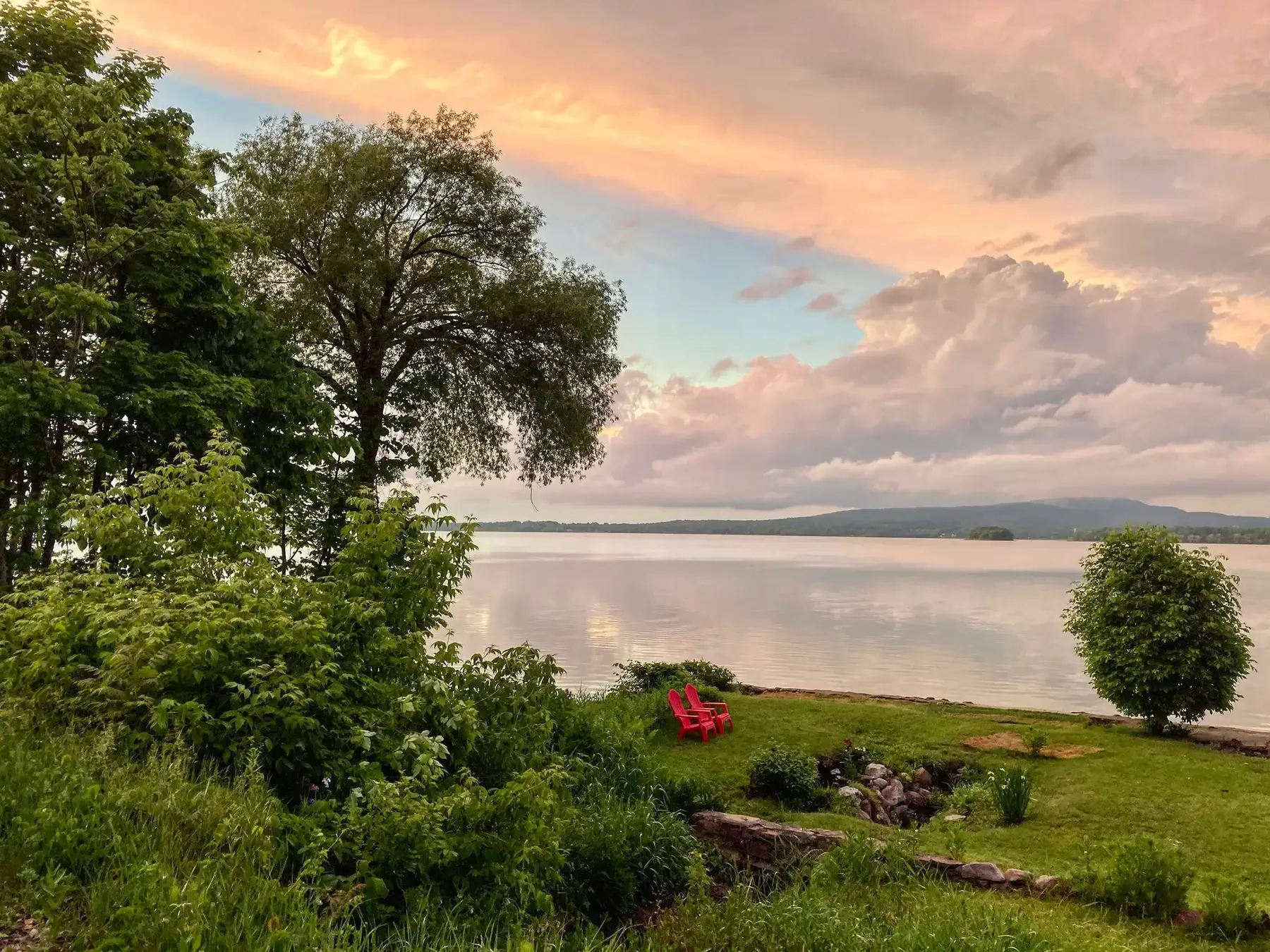
* Ottawa Neighbourhood Study figures for its “Westboro (includes Westboro Beach)” area, which is larger than Westboro Beach alone.
Westboro Beach is the riverside part of Westboro, north of the Transitway, and the only part of the area with direct public access to the Ottawa River. From the Westboro Beach centre it is about 10 minutes to Churchill Alternative School (OCDSB), 10 to Natural Food Pantry and 7 to the future Westboro O-Train station (under construction, opening listed for 2027) on foot (OSRM estimates). The Ottawa Neighbourhood Study's 'Westboro (includes Westboro Beach)' area had 12,280 residents in the 2021 census.
Updated · Facts on this page link to their sources
From the Westboro Beach centre
Walking and driving times to the nearest schools, O-Train stations and grocery stores.
| To | Nearest | Walk | Route | Drive |
|---|---|---|---|---|
| Elementary school | Churchill Alternative School (OCDSB) | 10 min | 780 m | 1 min |
| Elementary school | St. George School (OCSB, grades JK–6) | 19 min | 1.5 km | 3 min |
| Secondary school | Nepean High School (OCDSB, grades 9–12) | 25 min | 1.9 km | 4 min |
| Secondary school | Notre Dame High School (OCSB, grades 7–12) | 33 min | 2.5 km | 6 min |
| O-Train (open) | Tunney's Pasture | 28 min | 2.1 km | 4 min |
| O-Train (under construction) | Westboro (opening listed for 2027, provisional) | 7 min | 510 m | 1 min |
| Grocery store | Natural Food Pantry | 10 min | 730 m | 2 min |
| Grocery store | Farm Boy | 10 min | 770 m | 2 min |
Estimates from OSRM on OpenStreetMap data: walking at about 5 km/h on streets and paths (no waits at crossings), driving in free-flowing traffic. Calculated 2026-10-30. Map data © OpenStreetMap contributors (ODbL).
About Westboro Beach
Westboro Beach is the riverside part of Westboro, north of the Transitway, and the only part of the area with direct public access to the Ottawa River. Several transportation corridors run through it: the Transitway, the Trans Canada Trail, the Kichi Zibi Mikan, the NCC pathway system and the river itself. The NCC's Westboro Beach reopened on June 1, 2025 after a $21 million redevelopment that added a zero-carbon pavilion with a restaurant and cafe. Westboro's cottage-like houses survive mostly in this area north of Scott Street, and the community association says the area's growing popularity has brought new housing development. Richmond Road's shops are a few minutes' walk south.
Boundaries
Bounded by the Kichi Zibi Mikan (formerly the Sir John A. Macdonald Parkway) and the Ottawa River to the north and west, the Transitway/LRT corridor along Scott Street to the south, and Island Park Drive to the east (Westboro Beach Community Association map). It is the part of greater Westboro north of the Transitway; the NCC beach itself sits just west of the residential area on the river. westborobeach.ca google.com
Homes
Small residential streets (e.g. Ferndale, Selby, Lanark, Clearview, Remic) between the Transitway and the parkway. Cottage-like houses survive here from the area's cottage-country days, and the WBCA reports that the area's growing popularity has brought new housing development. Neighbourhood-level housing statistics are not published separately: ONS includes Westboro Beach in its 'Westboro' area. en.wikipedia.org westborobeach.ca
- The only part of the area with direct public access to the Ottawa River
- Westboro Beach about 0.38 km from the centre: supervised swimming (City lifeguards) in summer, kayak/paddleboard/canoe rentals and volleyball
- NCC beach reopened June 1, 2025 with a zero-carbon pavilion, year-round restaurant, cafe, lookouts and playground
- Winter: sledding and a multi-use winter trail for skiing, snowshoeing and fat-biking that leads to the pavilion
- Paul Dewar Field House hosts community events such as the WBCA AGM
- Volunteers restoring Atlantis Woods with the NCC and Rideau Valley Conservation Authority (two-year anniversary in Oct 2026)
- Farm Boy about 0.55 km away; Richmond Road shops a short walk south
Community
How Westboro Beach came to be
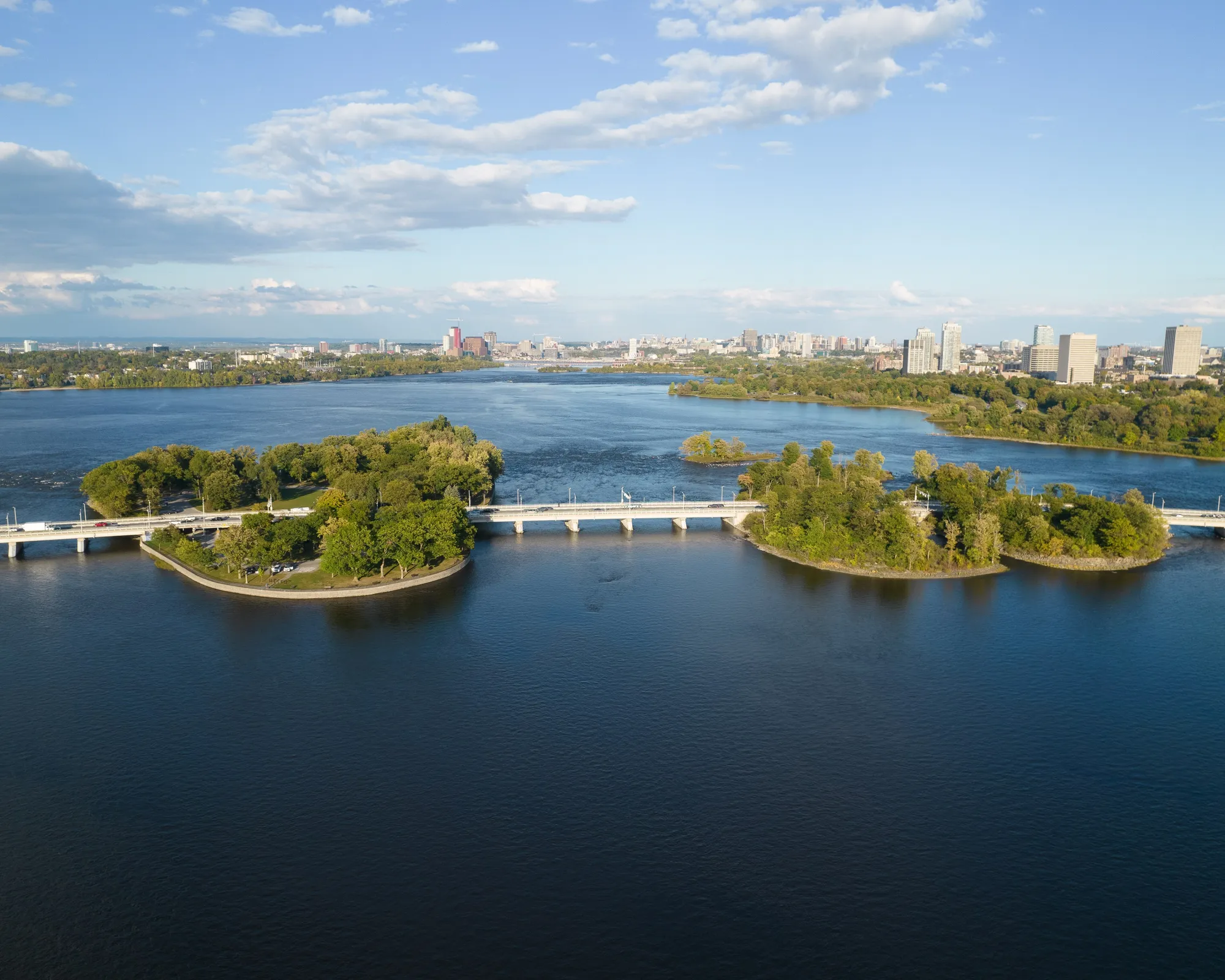
- 1869
James Skead bought land along the river around 1852; Skead's Mills was built there in 1869, burned in 1870 and was rebuilt by 1873. E.B. Eddy bought the mill in 1880, and it burned a few years later and was not rebuilt. hpraottawa.wordpress.com
- 1910
The beach was first recognized as a swimming site in 1910, when the "Clarella subdivision plan" set aside three parcels for public swimming; in 1926 the Westboro Board of Trade backed swimming there while the land was still privately owned (Kitchissippi Times, citing Friends of Westboro Beach, reproduced by the WBCA). westborobeach.ca
- 2025
The NCC reopened Westboro Beach on June 1, 2025 after a $21 million redevelopment, partly funded by the City of Ottawa under its LRT agreement with the NCC. The work added a zero-carbon pavilion, lookouts, a playground and outdoor showers. cbc.ca
Volunteers working with the NCC have mapped remnants of the foundation of the main Skead's Mill building near the shoreline rock platform. westborobeach.ca
Many of Westboro's surviving cottage-like residences are north of Scott Street near the river, a reminder of when the area was cottage country. en.wikipedia.org
Local names worth knowing
- James Skead
Lumberman whose Skead's Mills (1869) on the riverfront gave the early settlement its name before it became Westboro. hpraottawa.wordpress.com
Around Westboro Beach
Walking rings at 5, 10 and 15 minutes from the neighbourhood centre.
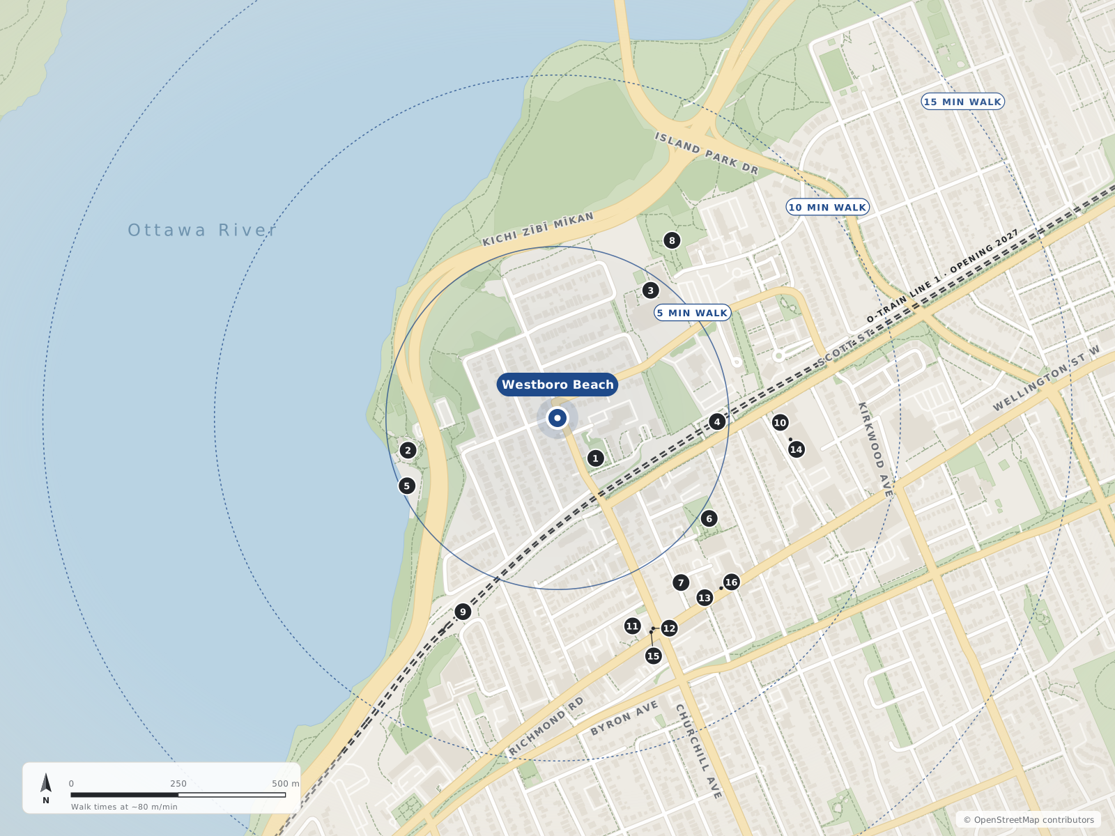
- 1Roy Duncan Park130 m
- 2The Grand Pizzeria (Westboro Beach)360 m
- 3Centre Jules-Léger370 m
- 4Westboro370 m
- 5Westboro Beach380 m
- 6Lion's Park420 m
- 7Elise480 m
- 8Riverside Terrace Park490 m
- 9Kichi Zìbì (formerly Dominion)500 m
- 10Natural Food Pantry520 m
- 11Churchill Seniors Recreation Centre520 m
- 12Gezellig540 m
- 13Happy Goat Westboro Café540 m
- 14Farm Boy550 m
- 15Cloudforest Coffee550 m
- 16Batter Up Bakery550 m
Schools
8 nearbyCentre Jules-Léger
Provincial281 Lanark Avenueopenstreetmap.org
370 m5 min walkBlyth Academy
Independent352 Danforth Avenueopenstreetmap.org
670 m8 min walkChurchill Alternative School
OCDSB345 Ravenhill Avenue Eastopenstreetmap.org churchillalternative.ocdsb.ca
730 m9 min walkHilson Avenue Public School
OCDSBGrades JK–6407 Hilson Avenueopenstreetmap.org hilsonaveps.ocdsb.ca
990 m12 min walkSt. George School
OCSBGrades JK–6130 Keyworth Avenueopenstreetmap.org sge.ocsb.ca
1.1 km13 min walkChesterton Academy
Independent415 Piccadilly Avenue Northopenstreetmap.org
1.4 km17 min walkNepean High School
OCDSBGrades 9–12574 Broadview Avenueopenstreetmap.org nepeanhs.ocdsb.ca
1.5 km19 min walkBroadview Public School
OCDSBGrades JK–8590 Broadview Avenueopenstreetmap.org broadviewps.ocdsb.ca
1.6 km20 min walk
Straight-line distances from the Westboro Beach centre. Living near a school does not guarantee a place: confirm the designated school for an address with each board. All schools and board locators.
Parks & places
10 nearbyRoy Duncan Park
City park on Churchill Avenue North; the Paul Dewar Field House is nearby on an Ottawa Community Housing site.
295 Churchill Avenue Northopenstreetmap.org openstreetmap.org
130 m2 min walkWestboro Beach
NCC-managed sandy beach on the Ottawa River with a designated supervised swim area in summer; the renovated site has pavilions, a year-round restaurant (the Grand Pizzeria) and a seasonal café, and in winter the Kichi Sibi Winter Trail leads directly to the pavilion.
745 Kichi Zībī Mīkanopenstreetmap.org openstreetmap.org ncc-ccn.gc.ca
380 m5 min walkLion's Park
City park on Elmgrove Avenue beside the Ottawa Gymnastics Centre, with the Lions summer wading pool.
294 Elmgrove Avenueopenstreetmap.org openstreetmap.org ottawa.ca
420 m5 min walkRiverside Terrace Park
City park on Clearview Avenue near the river (dogs allowed per OSM).
225 Clearview Avenueopenstreetmap.org
490 m6 min walkChurchill Seniors Recreation Centre
City of Ottawa seniors' recreation centre on Richmond Road in Westboro.
345 Richmond Roadopenstreetmap.org
520 m7 min walkMahoney Park
City park on Lanark Avenue.
160 Lanark Avenueopenstreetmap.org
600 m7 min walkOttawa River Pathway (Trans Canada Trail)
Multi-use cycling and walking pathway along the Ottawa River, part of the NCC's Capital Pathway network (200+ km of off-road pathways) and mapped in OSM as part of the Trans Canada Trail.
openstreetmap.org ncc-ccn.gc.ca openstreetmap.org
640 m8 min walkHeather Crowe Park
City park on Scott Street (leashed dogs per OSM).
1902 Scott Streetopenstreetmap.org
780 m10 min walkClare Gardens Park
Small City park on Clare Street in Westboro (no dogs per OSM).
269 Clare Streetopenstreetmap.org
1.1 km14 min walkIona Park
City park on Iona Street with a summer wading pool.
223 Iona Streetopenstreetmap.org openstreetmap.org ottawa.ca
1.2 km15 min walk
Shops & dining
10 nearbyThe Grand Pizzeria (Westboro Beach)
Year-round restaurant in the Westboro Beach pavilion (breakfast, pizza, salads); NCC lists hours Sun–Thu 8 am–10 pm, Fri–Sat 8 am–11 pm.
745 Kichi Zībī Mīkanopenstreetmap.org ncc-ccn.gc.ca
360 m4 min walkElise
French restaurant on Winona Avenue, a Westboro Village BIA member.
381 Winona Avenueopenstreetmap.org westborovillage.com
480 m6 min walkNatural Food Pantry
Natural/health food store on Scott Street, a Westboro Village BIA member.
1960 Scott Streetopenstreetmap.org westborovillage.com
520 m7 min walkGezellig
Restaurant in Westboro Village, a BIA member.
337 Richmond Roadopenstreetmap.org westborovillage.com
540 m7 min walkHappy Goat Westboro Café
Happy Goat Coffee Company's Westboro café, a BIA member.
307A Richmond Roadopenstreetmap.org westborovillage.com
540 m7 min walkFarm Boy
Farm Boy grocery store at 317 McRae Avenue, steps from Richmond Road.
317 McRae Avenueopenstreetmap.org westborovillage.com
550 m7 min walkCloudforest Coffee
Cloudforest Coffee café (OSM lists it with Pokoloko), a Westboro Village BIA member.
339 Richmond Roadopenstreetmap.org westborovillage.com
550 m7 min walkBatter Up Bakery
Bakery in Westboro Village, a BIA member.
303 Richmond Roadopenstreetmap.org westborovillage.com
550 m7 min walkThe SconeWitch
Café on Winston Avenue, a Westboro Village BIA member.
393 Winston Avenueopenstreetmap.org westborovillage.com
550 m7 min walkBridgehead
Bridgehead coffee shop on McRae Avenue, a Westboro Village BIA member.
319 McRae Avenueopenstreetmap.org westborovillage.com
570 m7 min walk
Getting around
TransitWestboro
Future trench-level O-Train station on Scott Street (Lines 1 and 3). The old Transitway trench closed in June 2022 for Stage 2 work, so buses currently stop curbside on Scott Street. Not open as of Oct 2026. OC Transpo (Mar 12, 2026) expected handover to the City in Q2 2027 and passenger service in Q3 2027; Canada Day 2026 flooding damaged parts of the extension between New Orchard and Moodie and OC Transpo has said it may open the extension in parts (CTV, Aug 5, 2026).
under constructionopenstreetmap.org en.wikipedia.org en.wikipedia.org
370 m5 min walkKichi Zìbì (formerly Dominion)
Future trench-level O-Train station replacing Dominion Transitway station by the Kichi Zībī Mīkan, about 225 m from Richmond Road and close to Westboro Beach. OC Transpo reported its elevators installed in 2025. Not open as of Oct 2026. OC Transpo (Mar 12, 2026) expected handover to the City in Q2 2027 and passenger service in Q3 2027; Canada Day 2026 flooding damaged parts of the extension between New Orchard and Moodie and OC Transpo has said it may open the extension in parts (CTV, Aug 5, 2026).
under constructionopenstreetmap.org en.wikipedia.org octranspo.com
500 m6 min walkRichmond Road bus corridor
Westboro Village's main street; OSM bus route relations on Richmond Road in the area include routes 11, 51, 81 and 153. Route numbers change — confirm on octranspo.com.
openopenstreetmap.org overpass-api.de
560 m7 min walkOttawa River Pathway (active transportation)
Off-road NCC multi-use pathway along the river, part of the 200+ km Capital Pathway network — a car-free cycling/walking route east toward downtown and west along the river.
openopenstreetmap.org ncc-ccn.gc.ca
640 m8 min walkFuture O-Train
Kichi Zìbì station (formerly Dominion; ~0.5 km) and Westboro station (~0.37 km) are being rebuilt for the O-Train Line 1 west extension, listed for 2027. Westboro's buses currently stop curbside on Scott Street.
O-Train timing caveat
CTV reported the west extension launch delayed to summer 2027 (Mar 12, 2026) and that Canada Day 2026 flood damage could mean a partial opening (Aug 5, 2026).
Cycling / walking
Capital Pathway and Trans Canada Trail along the river. Bike racks at the beach pavilions year-round.
Parking at the beach
Paid NCC lot across from the beach (66 spaces) plus an accessible drop-off area.
For sale in Westboro Beach
No Westboro Beach homes on westboro.homes right now
Selling here? Get a website for your home, or browse every home for sale in the area.
Neighbouring areas
Quick answers
Short answers first; each links to the full answer and its sources.
Can you swim at Westboro Beach, and what is there?
Yes. Westboro Beach is an NCC-managed sandy beach on the Ottawa River with a designated supervised swim area in summer. It reopened on June 1, 2025 after a $21 million redevelopment that added a zero-carbon pavilion with a year-round restaurant and a seasonal café.
As of 2026-10 · ncc-ccn.gc.ca ncc-ccn.gc.ca
What is the nearest working O-Train station to Westboro right now?
Tunney's Pasture, at Scott Street just east of the area, is the current western end of O-Train Line 1 and the nearest open station. It is about a 28-minute walk from the Westboro Beach centre and 30 minutes from the Westboro centre, or about 4 minutes by car.
As of 2026-10 · octranspo.com en.wikipedia.org
Is Westboro good for young professionals?
In the 2021 census, 53.6% of households in the ONS 'Westboro' area rented and 42.3% of dwellings were apartments in buildings of five or more storeys, so there is a large rental and condo stock. Richmond Road has cafés, restaurants and pubs, and groceries are about a 10-minute walk from the centre.
As of 2026-10-30 · ons-sqo.ca ons-sqo.ca
What is the Westboro Beach neighbourhood like?
Westboro Beach is the riverside part of Westboro, between the Scott Street Transitway corridor and the Ottawa River, east to Island Park Drive. It is the only part of the area with direct public access to the river, and the NCC's Westboro Beach, a swimming beach with a year-round restaurant, is about 0.4 km from its centre.
As of 2026-10-30 · westborobeach.ca en.wikipedia.org
What is there to do outdoors in winter in Westboro?
The volunteer-groomed Kichi Sibi Winter Trail follows the Ottawa River shore for skiing, snowshoeing, fat-biking and walking, and the NCC says it leads directly to Westboro Beach. City parks such as Westboro Kiwanis, McKellar and Woodroffe parks have supervised outdoor rinks.
As of 2026-10-30 · wintertrail.ca ncc-ccn.gc.ca
How far is Westboro Beach from the new O-Train station?
The nearest future O-Train station to the Westboro Beach centre is Westboro station, about a 7-minute walk. It is under construction for the Line 1 west extension and is not open yet; OC Transpo expected passenger service in the third quarter of 2027.
As of 2026-10 · westboro.homes openstreetmap.org